
International Consulting
Geospatial Information
Sri Lanka
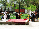
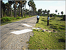 Photo control point installed in the project
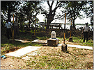 Control point installed during the British colonial period
| Title | : | Digital Topographic Mapping Project for Reconstruction of Northern Region |
| Period | : | February 2010 – June 2011 |
| Funded by | : | JICA |
Even after the end of Sri Lanka’s 30-year-long civil war in 2009, there were as many as 280,000 internally displaced persons (IDPs) in the northern area, and the stabilization of the said area and the return of the IDPs were of particular concern. The Japanese government considers “assistance for the consolidation of peace and the reconstruction process” as one of the pillars of governmental assistance for Sri Lanka, as described in its Country Assistance Strategy.
This project was to facilitate the stabilization of the northern area and the return of IDPs by the following three components.
- 1. Aerial photography of the whole northern area (about 9,000 km2) of Sri Lanka
- 2. Development of topographical maps at a scale of 1/10,000 of Mannar and Jaffna districts
- 3. Technology transfer on digital topographical mapping through the abovementioned activities
Afghanistan
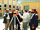
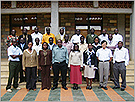
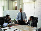 Meeting with Counterparts
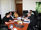 Technology Transfer to Counterparts
 Discussion on Inception Report
| Title | : | Project on Promotion of Kabul Metropolitan Area Development – Dehsabz and Barikab Areas Topographic Mapping (Basic Data) Sub-Project |
| Period | : | September 2010 – March 2011 |
| Funded by | : | JICA |
The population of Kabul, the Afghan capital, has increased rapidly from 2 million in 1999 to approximately 5 million in 2012, and this trend is expected to continue. As the population has grown, urban issues such as groundwater level drawdown and traffic congestion have become serious. Accordingly, JICA implemented the Development Study on Kabul Metropolitan Area from 2008 to 2009, whereby a master plan on the development of Kabul Metropolitan Area was developed and the development of new urban areas in Dehsabz and Barikab was proposed. Technical cooperation in the form of the Project on Promotion of Kabul Metropolitan Area Development got underway in May 2010 with the aim of promoting this master plan.
Kokusai Kogyo was in charge of the mapping component of this project, namely the development of digital topographic maps at a scale of 1/10,000 of Dehsabz and Barikab areas (and 1/5,000 for the planned area for Salang dam).
As shown below, Kokusai Kogyo was already transferring digital mapping technology to the Afghan Geodesy and Cartography Head Office (AGCHO) when this project got underway. Therefore, this project built on AGCHO’s newly acquired capacity such as in supplementary site surveys and digital mapping, to drill home the skills through further practical experience and to assess skills that needed additional training.
Afghanistan
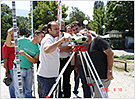
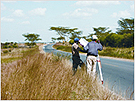
 Training with theodolites as part of the technology transfer
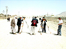 Surveying in the Field
| Title | : | Study on Topographic Mapping for Greater Kabul |
| Period | : | January 2008 – January 2011 |
| Funded by | : | JICA |
Kabul’s rapidly increasing population has caused various urban issues such as housing shortages and degradation of public health, and unregulated urbanization is becoming a significant problem. As such, the formulation of an urban development plan for Kabul and its surrounds was vitally required.
Consequently, this study aimed to prepare a topographic map which would be used for urban planning. Kokusai Kogyo developed a digital topographic map of Kabul City at a scale of 1/5,000 and an orthophoto map of the city and its peripheral area at a scale of 1/10,000. We also transferred digital mapping technology to Afghan Geodesy and Cartography Head Office in the course of the study.
Serbia

 Demonstration of digital plotting and technical transfer for field identification (Serbia)
| Title | : | Project for Capacity Development of Digital Basic State Mapping |
| Period | : | December 2009 – November 2011 |
| Funded by | : | JICA |
Serbia was part of the former Yugoslavia. After its dissolution, Serbia and Montenegro established a new state union. In 2006 when Montenegro became independent, the Republic of Serbia succeeded to the state union. As a newly independent country, developing spatial information starting with digital topographic maps is vital, particularly in the business sector, to invigorate the economy such as through urban and tourism development. Accordingly, a technical cooperation project started with technical input from Kokusai Kogyo aiming to establish a sustainable mechanism to develop, revise and provide digital maps.
The counterpart agency was the Republic Geodetic Authority. The project activities included on-the-job training and the preparation of manuals for digital mapping by the counterparts themselves, to reinforce the concepts taught in the training, as well as to highlight subjects that needed clarification. In the process we established a framework for future training programs in RGA to ensure it has the capacity for personnel development after completion of our project.
Montenegro
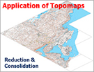 ap samples showing the versatile application possibilities of the map covering 70 % of Montenegro made up of more than ten joined digital topographic maps prepared in the two year survey
| Title | : | The Study for Establishment of Geographic Information for Implementation of National Physical Plan |
| Period | : | February 2007 – March 2009 |
| Funded by | : | JICA |
The Federal Republic of Yugoslavia was renamed Serbia and Montenegro in 2003 after its breakup. Montenegro became independent in June 2006, when the federation of Serbia and Montenegro was dissolved. A national land development program was formulated in an effort to restore and recover economic infrastructure and the standard of living that had deteriorated due to long-term economic sanctions and air strikes. It became, however, clear that the analogue topographic maps made in the 1970s were a major obstacle to the implementation of the program, and there was a pressing need to prepare digital topographic maps which were compatible with geographic information systems (GIS) and international standards. Accordingly, this study was carried out in response to the request of the Government of Montenegro for establishment of GIS.
The major outputs of the study included aerial photography of the whole country (14,000 km2), 1:25,000 scale digital topographic maps of 70% of the country and corresponding GIS databases. The counterpart, the Department of Real Estate of the Ministry of Finance, responsible for preparing spatial data infrastructure, carried out most tasks such as photo control point survey, photo interpretation and aerial triangulation, with technical support of our specialist. The counterparts are to complete the spatial data infrastructure, for the remaining 30% of the country, on their own. In this light, we paid particular attention to the transfer of necessary technology.
Swaziland
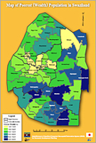 Sample thematic maps based on the 2007 Census released on the National Development Data Centre (NDDC) website
| Title | : | Establishment of Swaziland Integrated Geo-spatial Information System (SIGIS) for Economic Development Planning |
| Period | : | December 2007 – March 2010 |
| Funded by | : | JICA |
The government of Swaziland, attempting to put into effect its Poverty Reduction Strategic Action Plan, needed to accurately grasp its current socioeconomic conditions, to streamline its efforts to implement the plan, and to regularly compile monitoring data of the plan’s progress.
Recognizing such challenges, this project was started with the aim of establishing an integrated geospatial information system to consolidate geospatial and statistical information and to strengthen competency to utilize the information system.
Kokusai Kogyo was selected as a consultant and achieved the following:
- 1. A national development data center was established and statistics was aggregated and integrated,
- 2. Government officials were empowered with sufficient knowledge and skills in GIS, statistics and planning,
- 3. A development information management system for planning in the poverty, education and health sectors was constructed.
- 4. The accuracy of the system was improved by sharing knowledge on development management information systems with neighboring countries.
Kenya
 Training participants for GIS users and training scene (Kenya)
| Title | : | The Project for Strengthening of Survey of Kenya for GIS Promotion |
| Period | : | October 2006 – October 2008 |
| Funded by | : | JICA |
In Kenya, there is a desperate need to develop infrastructure such as roads, water supply, sewerage, power, housing and telecommunications. This situation was exasperated by the fact that there is no system with which to acquire and share spatial information needed to develop such infrastructure. One of the aims of Kenya’s National Development Plan was to establish a National Spatial Data Infrastructure (NSDI) that would standardize and commoditize spatial information, however, the primary organization for NSDI development, Survey of Kenya (SOK), lacked technology related to NSDI, GIS or map digitization. Consequently, this technical assistance project was started as the first step towards developing an NSDI.
Kokusai Kogyo prepared map digitizing manuals and trained SOK operators to improve their skills and quality of their work because it had been quite erratic. Spatial data infrastructure standards were also drafted to facilitate sharing of spatial information by GIS users. Further, a clearinghouse and sample GIS maps were made available on the Internet in order to promote the wide use of spatial information. The map digitizing technology of SOK and the environment of GIS usage, which were developed by this project, will contribute to the future steps towards establishing a NSDI.
Former Yugoslav Republic of Macedonia
 Field training by Kokusai Kogyo’s engineers (Macedonia)
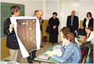 Map education at school (Macedonia)
| Title | : | Study for Establishment of State Base Maps for GIS |
| Period | : | 2004 – December 2006 |
| Funded by | : | JICA |
The Republic of Macedonia is a small, landlocked country located at the south end of the former Yugoslavia, and is surrounded by Albania, Greece and Bulgaria. The country was not able to develop state base maps by itself after independence, and thus this study was carried out with three purposes: the development of new digital state base maps, technical transfer related to mapping, and dissemination of spatial information.
During the course of the development of new digital state base maps, we acquired aerial photo image data covering 25,713km2 of the entire national land area, produced 105 sheets of state base maps with a scale of 1/25,000 for 55% of the national land area and built a landuse database and an environmental database for an area of about 3,556km2. In doing so, we also transferred such technologies as ground survey, digital photogrammetry and GIS to our counterpart, the State Authority for Geodetic Works (SAGW).
When Macedonia was a part of the former Yugoslavia, spatial information was strictly controlled and considered a military secret, so maps were not publicly available. Even after independence, tedious purchase procedures and high prices made it difficult for private citizens to access maps. For the dissemination of spatial information, the third purpose of the study, we organized forums and an environmental map contest, whereby people could recognize how maps could be interesting and useful. The contest drew particular attention, receiving as many as 276 applications. For better availability of maps, we succeeded in removing the permit system prior to map purchase, considerably reducing map prices, and initiating the sale of digital maps. Further, as part of the openness of SAGW, posters and newspaper advertisements were published to announce the new availability of maps.
Kenya
| Title | : | The Study for the Establishment of the Spatial Data Framework for the City of Nairobi |
| Period | : | December 2002 – March 2005 |
| Funded by | : | JICA |
The City of Nairobi has experienced a rapid increase in population with an influx of immigrants from rural areas, and the city infrastructure (water supply, sewerage, land management, waste disposal, health and sanitation, etc.) is not sufficient to meet the growing demands. However, the city’s 1:2,500-scale maps, the most basic geographic information, were produced 30 years ago and do not cover the entire city. As they have not been updated or expanded, they do not represent current conditions and cannot be used to formulate urban development plans.
In the study, we developed a geographic information system to manage the city’s infrastructure. Specific activities included: i) aerial photography (scale: 1:5,000; color) covering an area of 702 km2, ii) ground control point survey (22 points), iii) ordinary leveling (350km), iv) aerial triangulation (249 models), v) field identification (585 km2), vi) production of 1:2,500 topographic maps (170 km2), vii) production of 1:5,000 topographic maps (415 km2), viii) consultation on GIS related tasks and design of GIS (15 km2), and ix) GIS database construction.
Sort by region
| Geospatial Information | Forestry | Disaster Risk Reduction | Energy |
| Water and Sanitation | Agriculture | Urban Development | Others |
Sort by sector
| Asia | Middle East | Europe | Africa |
| South and Central America | Oceania | Worldwide |