Climate change countermeasures
Analysis of water quality / Water flow analysis

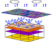
Before river alteration, erosion control, and agriculture and forestry operations can be undertaken in areas that include a river, it is necessary to create a distributed river discharge estimation model that includes the river discharge at a given spot, the groundwater level, and the soil water content, all of which are important factors comprising the land base.
A distributed river discharge estimation model is the most powerful tool for computing the river discharge at a given spot, the groundwater level, and the soil water content, etc. Kokusai Kogyo’s distributed river discharge estimation model takes land use, vegetation, soil, and geology into consideration, resulting in the creation of extremely practical, high-precision models with a high level of reproducibility.
- We can accurately estimate the hydrological conditions at any spot in the land space.
- We provide both radar precipitation estimates and ground-level precipitation estimates.
- Our data can be used for modeling floods, droughts, and slope ruptures, as well as for their validation.
- We can create a real-time system for forecasting floods, droughts, and slope ruptures.

