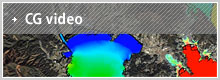
CG Video
Updated Jun. 19. 2011
This is a CG simulation of the tsunami based on the source model of the recent earthquake. It shows how the tsunami rushes inland with secondary and tertiary waves following one after the other.
Tsunami simulation (CG)
| ■[Rikuzen-takata, Iwate] with velocity shift data; Background − topographic map | ■[Rikuzen-takata, Iwate − wide area] with infrastructural data; Background: IKONOS image |
| ■[Kamaishi port, Iwate] Background: IKONOS image |
■[Otsuchi port, Iwate] Background: IKONOS image |
| ■[Kamaishi port, Iwate] Background: topographic map |
■[Otsuchi port, Iwate] Background: topographic map |
| ■[Soma port, Fukushima – 1] with current velocity shift data |
■[Soma port, Fukushima – 2] |
| ■[Fujii/Satake model − wide area]
note: The source model uses factors in the Fujii/Satake model (2011). |
|