Data
Measurement Database
-
PAREA-LiDAR
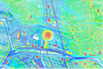 Provides high-density, high-accuracy 3D spatial data as library data, obtained through laser scan measurements.
 -
PAREA-OrthoPhoto
 Provided as orthophoto data based on high-definition, high-resolution aerial photo data. Since there is also image data with positional coordinates which makes it highly compatible with map data, it can be used for a wide-range of applications, including use for planning purposes and for 3D city models.
 -
Satellite Imagery
 Sales agency for satellite photo data created using satellites including ultra high-resolution satellites and SAR satellites, which are capable of observing the Earth through clouds or at night.
Map Database
-
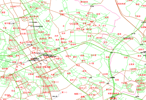
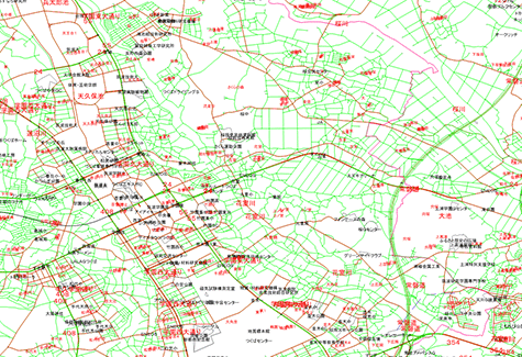
PAREA-Road
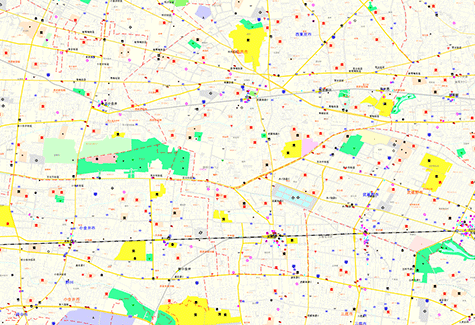 This 1:25,000 map database includes road, river, coastline, railway, city and town border, and similar information as well as annotations, including city/town names and the names of major locations. Data is provided in separate layers by item and is provided for the whole of Japan.
 -
PAREA-Traffic
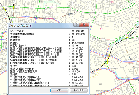 PAREA-Traffic provides data collected from the 2010 Road Traffic Census General Traffic Volume Survey conducted by the Ministry of Land, Infrastructure, Transport and Tourism as GIS data. In addition to survey spot data and attribute data (survey item data) consisting mainly of traffic volume data, there is road section data which includes road section shapes.
 -
GEOSPACE Electronic Maps
 A highly accurate (1:2,500 scale for habitable regions, 1:5,000 scale for mountainous regions) detailed map database (including feature, house shape, and road information) of rural areas. Available in both the “Basic” version , which includes district level address information in highly accurate maps, and “Standard” version, which includes major landmarks and building address (block and house number information level), to suit the purposes of different users.
 -
Digital Road Map Database
 This 1:25,000 scale map database includes map information for roads, rivers, coastlines, railways, municipality administrative borders, etc. which are at least 3m in length as well as annotations, including city/town names and the names of major locations. Data is provided in separate layers by item and is provided for the entire Japan. In addition, the database features data from a road network consisting of nodes and links and some traffic census information.
 -
Advanced Digital Road Map Database
 This database produced by Sumitomo Electric Industries based on DRM (Digital Road Maps) provides road data in more detail. Data is provided in separate layers by item and is provided for the entire Japan. In addition, the database features data from a road network consisting of nodes and links and traffic control information.
 -
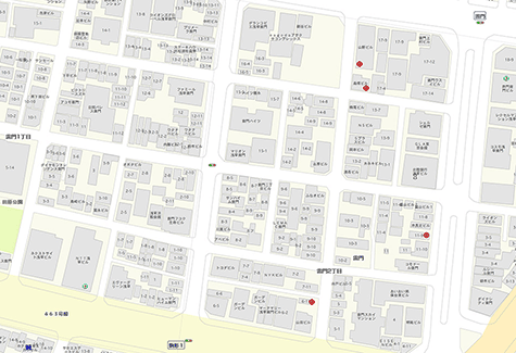
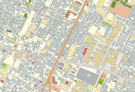
1:2500 Urban Map Database & Address Point Set
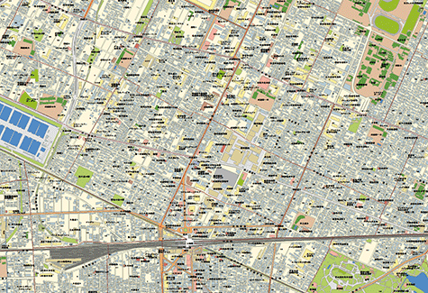 This 1:2,500 scale map database is a set product that includes city/town block data, facility information, house shape data, and addresses point data (block and house number level). Data is provided in shape format.
Facility Database
-
PAREA-Medical
 PAREA-Medical is the database consisting of location and attribute information (including addresses, telephone numbers, operation hours, subject of medical treatment, and so on) for approximately 83,000 hospitals and medical clinics throughout Japan. In addition to basic data such as medical facility names and addresses, also a vast amount of optional attribute data is available.
 -
PAREA-Dental
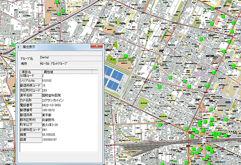 PAREA-Dental is a database consisting of location and attribute information (including addresses, telephone numbers, and so on) for approximately 53,000 dental clinics throughout Japan.
 -
PAREA-Care
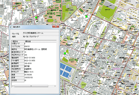 PAREA-Care is the database consisting of location and attribute information (including addresses, telephone numbers, and so on) for approximately 8,400 care facilities (rehabilitation facilities for the elderly, special elderly nursing homes, and hospitals with health facilities for recuperation) throughout Japan.
 -
PAREA-CareⅡ
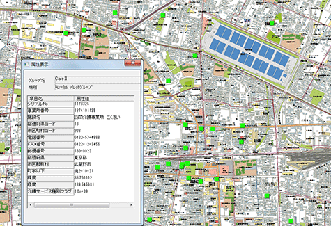 PAREA-Care II the a database consisting of location and attribute information (including addresses, care services by types, and so on) for approximately 130,000 care service businesses throughout Japan.
 -
PAREA-School
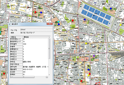 PAREA-School is the database consisting of location and attribute information (including addresses, telephone numbers, and so on) for approximately 64,000 schools throughout Japan.
 -
PAREA-Hazard
 The database of approximately 70,000 disaster refuse locations, including temporary evacuation centers and evacuation areas specified by local governments, throughout Japan. In addition to the location and elevation information for evacuation centers, PAREA-Hazard also includes attribute information such as information by disaster type (earthquake, windstorm, flood, etc.), location capacity, and so forth.
Administrative boundary Database
-
PAREA-Japan
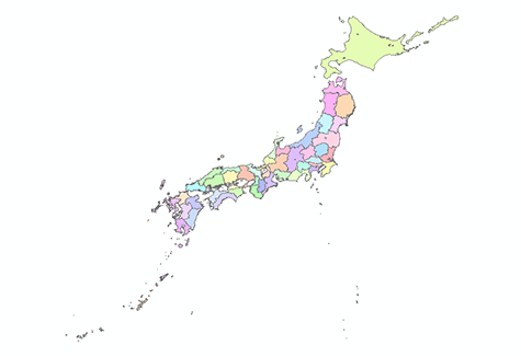 This database is the municipality administrative border data, which is used as a simple map. Used for displaying statistical data of each municipality.
 -
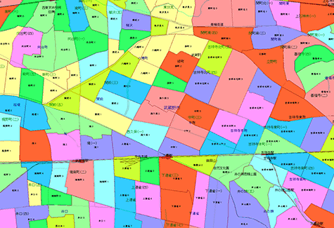
PAREA-Town
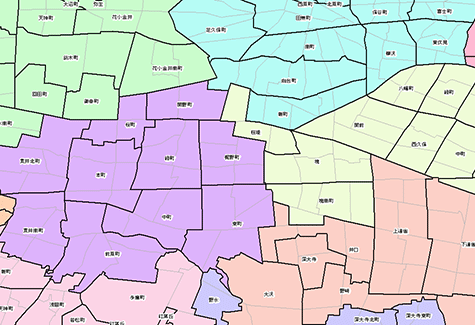 PAREA-Town is the database consisting of town district names and boundary information for approximately 180,000 throughout Japan. This data was created based on data from each municipality. Used for area marketing and other purposes. Note: Data for small village sections is available as optional data (approx. 250,000 points).
 -
PAREA-Zip
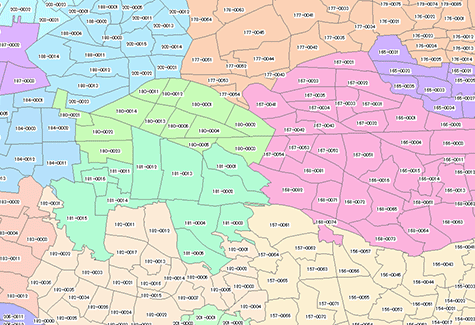 PAREA-Zip is the map database that is made with polygon of 7-digit postal boundaries (does not include individual postal for locations such as offices which receive large volumes of postal mail).
 -
PAREA-Address
 The address point database which includes all address items including house and block number, district name, large village section name (when applicable), city, town, or village name, and prefecture name. PAREA-Address can be used to perform address searches and for address matching purposes.
Statistical Database
-
PAREA-Stat. ALL
 PAREA-Stat. ALL is the comprehensive statistical database which includes census, commercial statistics, office and company statistics, and daytime population from other our products, PAREA Stat. series. The data composed as a set product to provide many kinds of statistical data.
 -
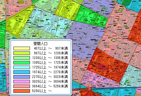
PAREA-Stat. Population
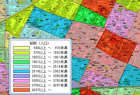 PAREA-Stat. Population is the database comprised of all types of population, population density, area, and household information based on national census data from the Ministry of Internal Affairs and Communications. Basic indicators (population and number of households by district) are estimated through calculation and updated annually.
 -
PAREA-Stat. Commerce
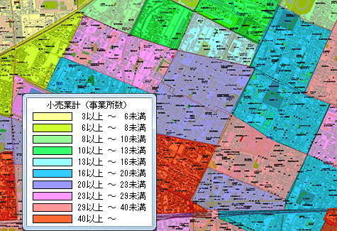 PAREA-Stat. Commerce is the database designed for wholesale and retail offices, which mainly includes the number of offices and employees of the retail industry, based on Census of Commerce data from the Ministry of Economy, Trade and Industry.
 -
PAREA-Stat. Office
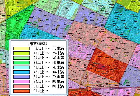 PAREA-Stat. Office is the database of number of offices by industry/employee scale, management organization, office type, time of establishment, etc. as well as number of corporations by number of employees, scope of employment, and level of capital, etc. based on Establishment and Enterprise Census data from the Ministry of Internal Affairs and Communications.
 -
PAREA-Stat. Population-Office LINK
 PAREA-Stat. Population-Office LINK is the database that contains daytime and nighttime population information as well as other statistical information obtained by using select items from combined national census data and Establishment and Enterprise Census data from the Ministry of Internal Affairs and Communications.
 -
PAREA-Stat. Income.Light
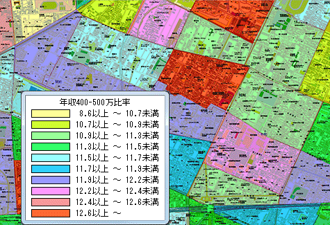 The database product which contains household information by annual income by district estimated by using an annual income rank model based on national census data from the Ministry of Internal Affairs.
 -
Population Statistics Database (Zip Version)
 This statistics database presents data on population by gender and the number of households for each postal code district. The data is contained in the National Population Statistics Master, which is compiled as of April 1 of each year based on the Basic Resident Registration.
 -
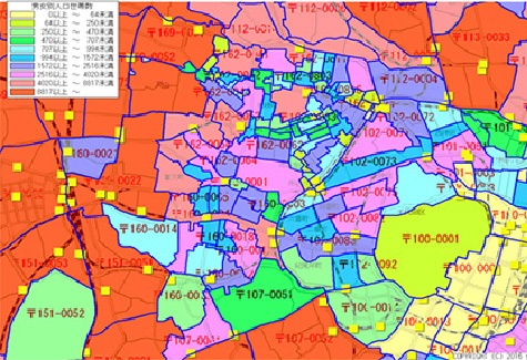
Mobile Spatial Statistics
 Mobile Spatial Statistics provides population statistics information that is based on DOCOMO mobile phone network data.
Users have access to hour-by-hour population distribution data of throughout Japan 24 hours a day, 365 days a year. This is a new type of population statistics, which shows what type of people move from where to where and when.
Mobile Spatial Statistics is a registered trademark of NTT DOCOMO, INC. -
Past Meteorological data
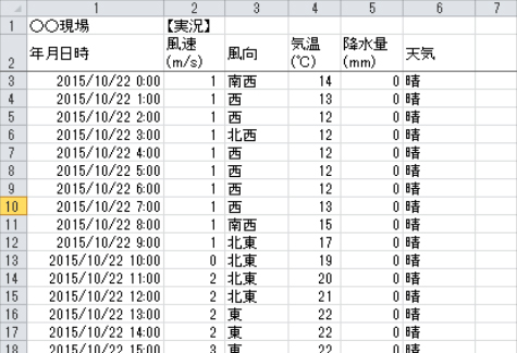 Database product which contains the past weather, temperature and precipitation data in 1km mesh unit. This can be used to analyze the behavioral patterns, sales patterns, and the accident cause which arise from the meteorological phenomena.