
Geospatial information services
Location-based service platform
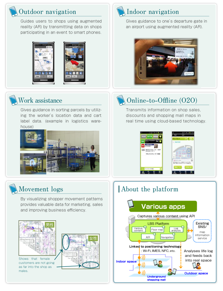
A location-based service (LBS) platform provides infrastructure for seamless positioning both indoors and out, and for various types of visualization that can be used by anyone. This enables provision of a range of content – from tourist and shopping information to local event and disaster prevention information – in real time and linked to the user’s actual location.
- Seamless navigation indoors and outdoors using multiple technologies including GPS, Wi-Fi and pedestrian dead reckoning (PDR).
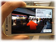
- Can transmit information according to the purpose or target using map and augmented reality (AR) technology, push notification and voice guidance.
- Can be used on all kinds of devices from smart phones and tablets to wearable devices.
- “ARrow Map”, a map/AR navigation app that can be used on various devices, was introduced at Epson’s new product launch in January 2014.
- Developed an app for trialing a logistics solution using head-mounted device and an AR navigation system (September 2013).
- Exhibited proprietary indoor navigation app at Epson Business Integration Forum, July 2013.
- Developed a trial app for promoting various nightlife events in Kanazawa, Ishikawa Prefecture and Tokyo in March, May and October 2013.
- Participated in a project to showcase how location data can make outings more enjoyable, the Location Cruise Project, which is part of the Ministry of Economy, Trade and Industry’s G-spatial project (February 2012).
- Provided technology license for “JAL AiRport Navigation” for navigating in Tokyo’s Haneda Airport, from 2011.