
Climate change countermeasures
Services for conservation of forest and environmental resources
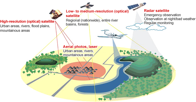
We acquire basic information on forests from the air through remote sensing to assist in conservation of forest environments, a valuable means of carbon dioxide sequestration. We use a combination of data from optical and radar satellites to aerial photography and laser data to accurately survey forest characteristics such as type, height and density of trees. The acquired basic information is put to use in numerous ways such as developing forest conservation plans and countermeasures, protecting biodiversity and combating climate change.
- We develop basic data necessary for forest conservation using geospatial information such as satellite and aerial imagery and laser data.
- We develop forest conservation master plans based on the basic data, which are an effective means of sustainably managing forest resources.
- We are active in REDD+ (reducing emissions from deforestation and degradation) initiatives, a valuable way of combating climate change.
- Gaining a clear and accurate grasp of data on forests, an important habitat for a wide range of flora and fauna, is invaluable in preserving biodiversity.